074
Upper Buffalo Wilderness Area
4/14/2012
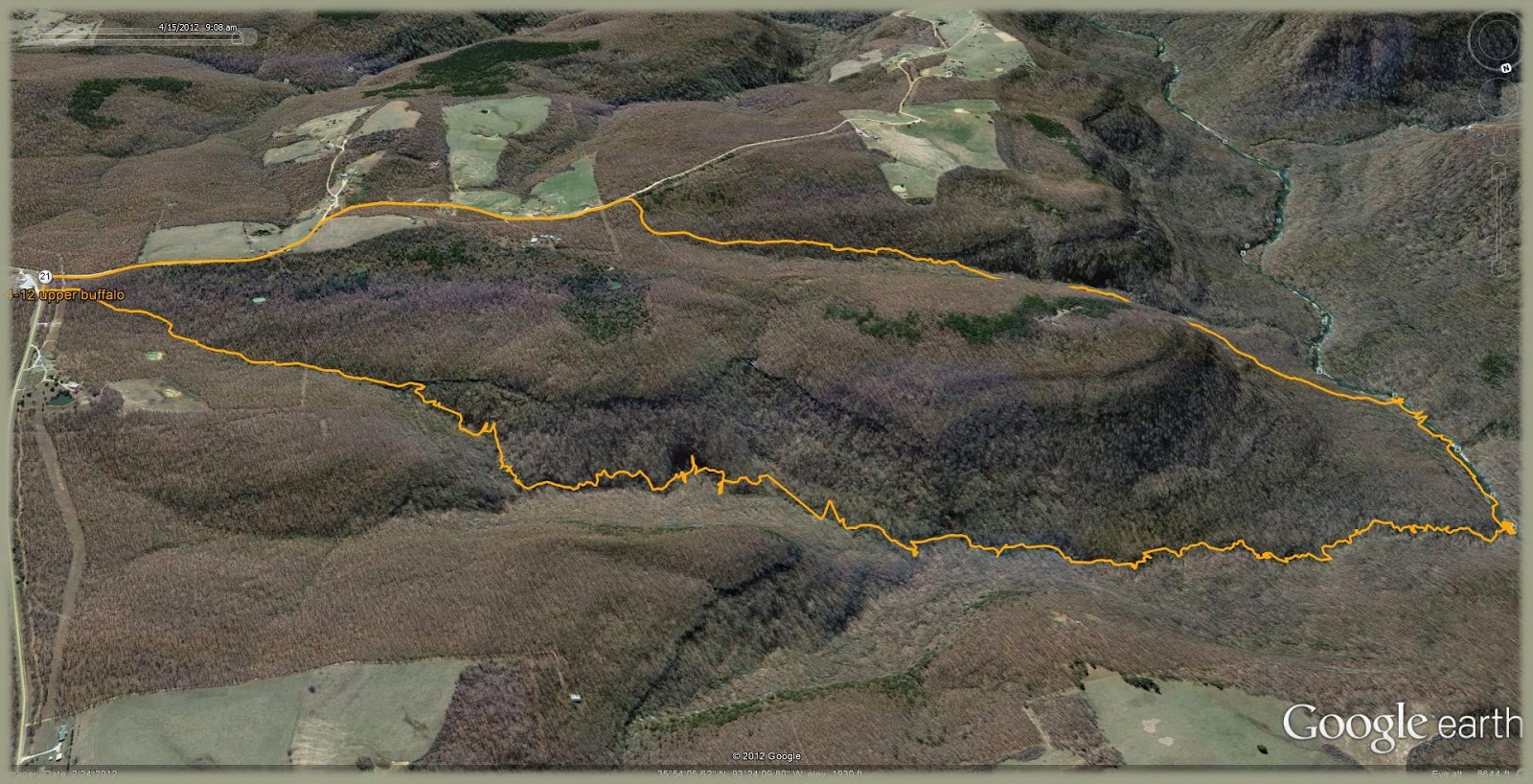
This past weekend looked a little iffy since there was unstable air to the west and who knows how accurate the weather forecasters are going to actually be.....having been let down plenty of times in the past. Well...we decided to give it a go anyway. My brother and I made plans to follow another of the numerous hollows that feed the Upper Buffalo River. We were to meet at Cracker Barrel in Conway at 6:00 a.m. but as is his way....he was late by an hour or so. If you recall I like to enter the forest early and he is pretty much the opposite. I guess we started the hike around 09:45 after parking at the Mossville Baptist Church on Hwy 21. On the drive up we hit some light rain and we wondered what we might be in for. The wind was 10-20 mph and potential for tornadoes in Oklahoma made us a bit cautious. The hike to the river took us till about 2:00 and we had some very light rain along the way. This was a slow journey due to well leafed out trees at first with the usual underbrush and tree obstacles. Once the bluff line was breached and the first dry waterfall was past we entered a creek bed that was intermittently flowing with wet sweaty rocks...and I mean rocks. It was very humid, about 65 degrees. 2/3 of the creek's duration was boulder city with the other 3rd having a moderate gradient. We stayed within the confines of the creek banks most of the time...so there was much scrambling over the rugged terrain. Many a bullfrog was encountered and one brown skink...but little other wildlife. We did observe many Bigleaf Magnolias in bloom along with some wild pink azaleas that were pleasantly fragrant. Nats, mosquitos and the like were not bad.
Upon arrival to where the creek and Buffalo meet, the clouds began to clear a bit an we felt the promise of better weather. We partook of some luncheon foodstuffs and rested our loins upon the banks of the river. A buzzard hovered nearly still high above, his stinky beak aimed into the southerly wind...and floated there...as if...a kite. After lunch we meandered upstream in search of a suitable campsite. The going was easy and numerous deer and raccoon tracks were noted along the way. We walked right past the entrance to Dug hollow without notice, and soon came upon an elevated gravel bar with a small bluff across from it. This was the spot. We unloaded and made camp, gathered wood and prepared all the arrangements for the evening. By now it was 4:00 or so and the skies were now clear. Things were once more looking up. Temp had climbed to near 80. There was plenty-o-gravel on the bar...a beautiful low bluff with water dribbling from numerous cracks an holes...and a small rapid just upstream, with a calm pool just off the shore. By nightfall there was a clear sky with no moon...wind was still quite active...but it was very comfortable out. Bugs were not bad at all...and the bats had come out to play above us. We sat by the fire till 11:00 and then crawled into our sleeping quarters. The night remained mostly clear with a low at 65 comfy degrees.
We rose at 6:00 and the clouds were coming back again. There was no rain through the night. Gear was stashed and we were on foot by 7:15. We cut across the corner and paralleled the creek within Little Pine Hollow. (Little Pine Creek?). The map showed this hollow to be quite steep and about half as long as Pine Hollow and we did not savor the thought of climbing over wet boulders heading out of the woods. It had begun to lightly rain on and off now. This morning was a near duplicate of Saturday morning. Climbing out was still quite steep and lush but we managed to reach the vehicular device by 9:05. I wish I could have seen what was in Little Pine Hollow as well, but maybe some other time. This was a good trip and we feel we got pretty lucky not having any real rain. Total miles around 8.